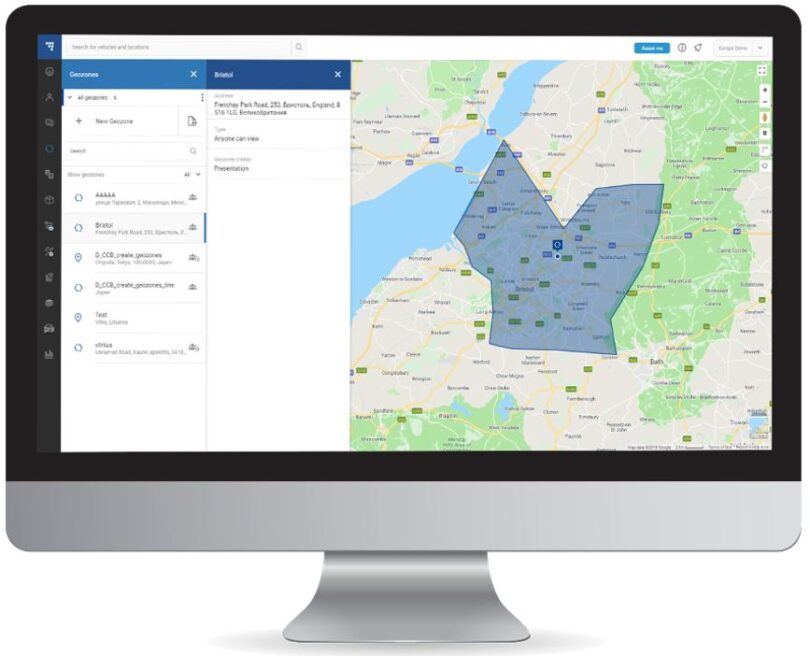
Main highlights of the feature
How does it work?
Imagine that you can designate a certain area on the map. For example, you would like the X truck from your fleet not to leave a specified zone – this is the driver’s area to which the vehicle is assigned. Therefore, if the vehicle leaves that zone, you are alerted that something went wrong. But how would you know what is happening with the truck at any given moment while sitting behind your desk? You would have to track the vehicle constantly in the system. Wouldn’t it be better to simply be informed when the car leaves the designated area?
Let’s look at another situation: you would prefer truck X not to go into a specific, designated terrain – for example, you transport explosives and for safety reasons, your drivers must stay away from certain industrial facilities. How would you know if truck X has just entered an area where you would prefer it not to operate?
In both cases, geozones are the answer. How does it work? All you have to do is set the boundaries of such a zone in the system and specify whether a given vehicle is to function within its boundaries or, on the contrary, to avoid driving into it. To do this, enter the terrain data in the TrustTrack system – e.g. GPS coordinates – and mark the width of the zone. Each time its limits are exceeded, you will receive a notification in the way you choose in the program. Geozones module is not limited to vehicle control only – it can be applied to other purposes as well.
Geozones – useful for various scenarios
Geozones are basically the working areas of your fleet’s vehicles. They are especially useful in the case of frequent abuses like the use of company vehicles for private purposes, in case of the theft of company resources, including equipment or the theft of the vehicles themselves. However, like many of the other features offered by Ruptela’s TrustTrack, it can also be used for completely different activities. Many companies use geozones to designate appropriate areas of operation for their sellers, couriers, or sales representatives. It is a tool that gives great data for analysis for people responsible for organizing the work for salespeople. A common struggle is the fact that sales representatives are unable to get to the right places on time or are competing for specific customers. Geozones module makes it possible to obtain information on how employees really function and, in this way, helps to analyse what can be improved.
Bringing efficiency to your company
At the beginning of the whole process, the zones are set approximately. After a few or a dozen days, however, the results of work imposed on the zones can be analysed – it may turn out that there are actually too few representatives in a given area, and too many in another, and that can be fixed with simple transfers. Of course, the results can also show that there are frauds taking place. Each time it is worth drawing the right conclusions and adjusting the workspaces of employees with the help of geozones. After a few more analyzes, the division of the entire working territory will be clear and will ensure the highest possible optimization of working time and results.
 EN
EN
 ES
ES LT
LT PL
PL BR
BR UA
UA MX
MX
